When I moved back down to Southern California from Bishop in the Eastern-High Sierra, I thought I would not like it very much because of how developed it was. In Bishop I was used to walking just a few blocks from my house to the countryside. For a nature/landscape photographer like me, it was a perfect place to live because places to shoot such pictures were so close. In So Cal, in most areas, you have to drive a while, sometimes hours, to find a wild or rural area. And if you didn't have a car or it was broken down, you'd have to take a bus which aren't always reliable.

Alas, I found myself settled in the city of Banning because of a job I got there and a place I could afford. It is off the I-10 between Redlands and Palm Springs. At first, I didn't much care for it. It was a So Cal city like any other So Cal city: an area still rural but was in the process of becoming covered with suburban sprawl, and full of its share of gangs and other types of criminal elements and crimes. Slowly, I began to explore my new home and after months of living there discovered open areas that remind me of Bishop, remind me of home. And while,sadly, I know some of that open area will be eventually and inevitably developed with cookie-cutter housing tracts and bland strip malls, some of it is protected or owned by utility companies and kept undeveloped for their own reasons.That, along with the fact that the "big city," malls, and the beach are relatively close (just a few hours drive at most), is making Banning my second love, though my heart still and will always belong to and in Bishop. After a year of debating it, I've decided I could make it here after all. Though returning to Bishop will always be my real goal.


My favorite spot I recently discovered is an area of rock outcroppings right at the foot of the San Jacinto Mountains just a few minutes from my house (to the south). And I've taken many pictures there. While sitting at the rocks, I've always noticed the open grassland and dry wash below me and planned to one day explore it. Today, on Monday, March 29, I impulsively decided to do so. I say
impulsively because I didn't actually plan it. I just said, "I want to explore that spot," and walked off. I must have walked miles, beginning by descending a steep hill that I warned myself I'd have to climb back up to get back to my car, so not to get too tired or sore. I've done this before: impulsively exploring, sometimes even without taking water. I just get so excited and so caught up in the moment that I forget some important things, like the fact that soon I would be thirsty, and the time flies by very quickly. This was one of those situations.
 T
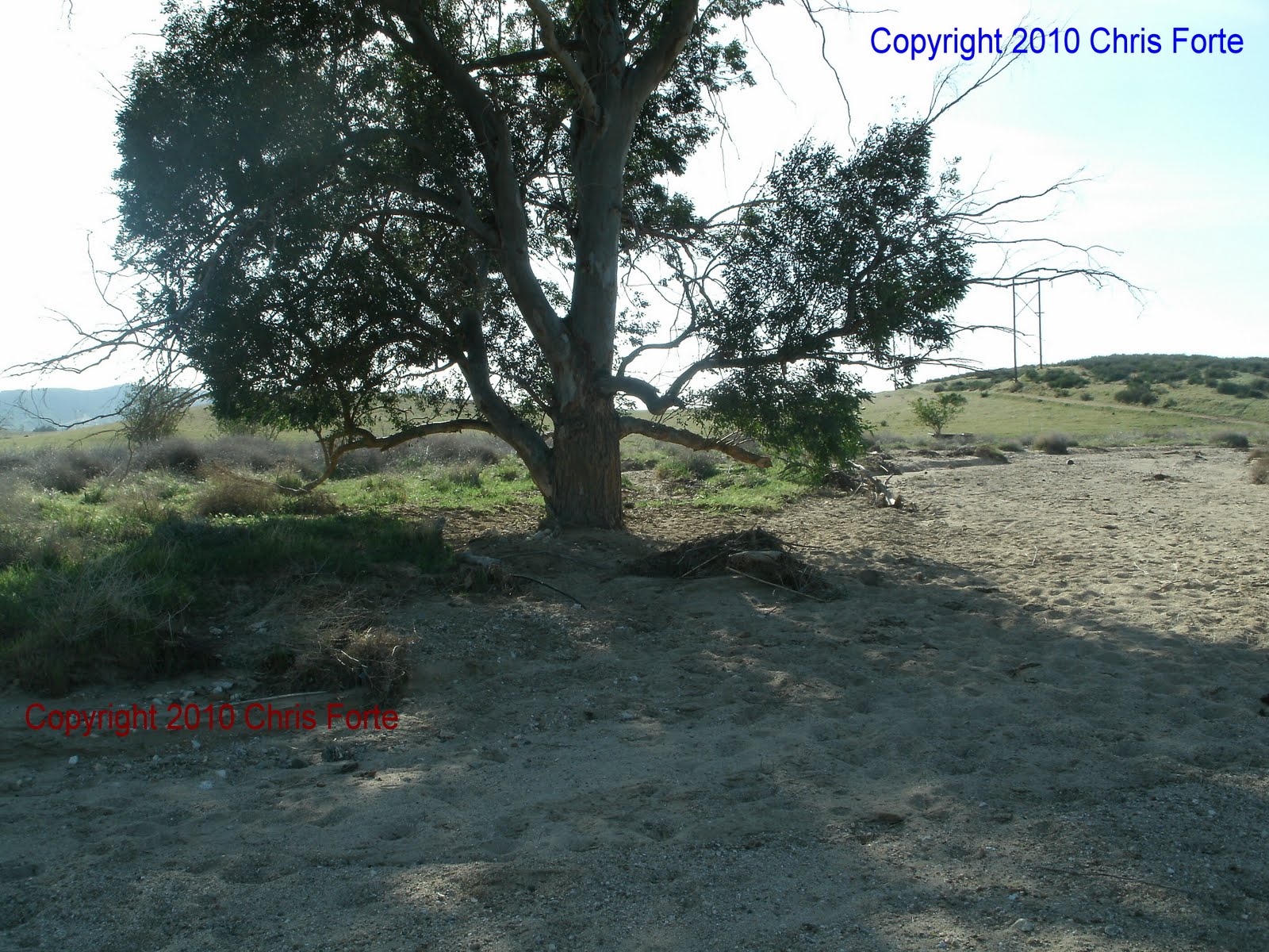
Thankfully, this time I had water with me and wisely decided not too go too far. I followed a branch of the wash a little ways to a lone tree creating a cool, shady spot to rest and take pictures in and from (it was 80 degrees, but after walking a ways, it felt warmer.). I took these pictures there.

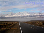
While this whole area of the San Gorgonio Pass from Calimesa to Palm Springs reminds me of the Owens Valley; a narrow desert valley that has some wild grassy areas and sparse, lonely trees with tall, forested alpine peaks surrounding it, a major difference is how dry the pass area, Banning is. While Bishop lies in the High Desert, it sits literally at the foot of the 14,000-foot Sierra Nevada Mountains, where snow can linger for months into the summer and the glaciers, of course, are there year-round, allowing cold creeks and rivers to flow in to and through out the valley all year. Meanwhile, Banning sits in So Cal where it only rains and snows a few months during the winters and the snow that does fall melts very quickly because the mountains are no higher than 11,000 feet and there are no glaciers. Consequently, the majority of the creeks and rivers only flow periodically through-out the year and only during good storms.
 S
Such is the fact with the wash I was exploring as shown in these pictures. Water or not, however, it was still a peaceful spot, a good spot for wild photography, and one that I will frequent quite regularly.


 Thankfully, this time I had water with me and wisely decided not too go too far. I followed a branch of the wash a little ways to a lone tree creating a cool, shady spot to rest and take pictures in and from (it was 80 degrees, but after walking a ways, it felt warmer.). I took these pictures there.
 Such is the fact with the wash I was exploring as shown in these pictures. Water or not, however, it was still a peaceful spot, a good spot for wild photography, and one that I will frequent quite regularly.


